Cities do not always move with their countries
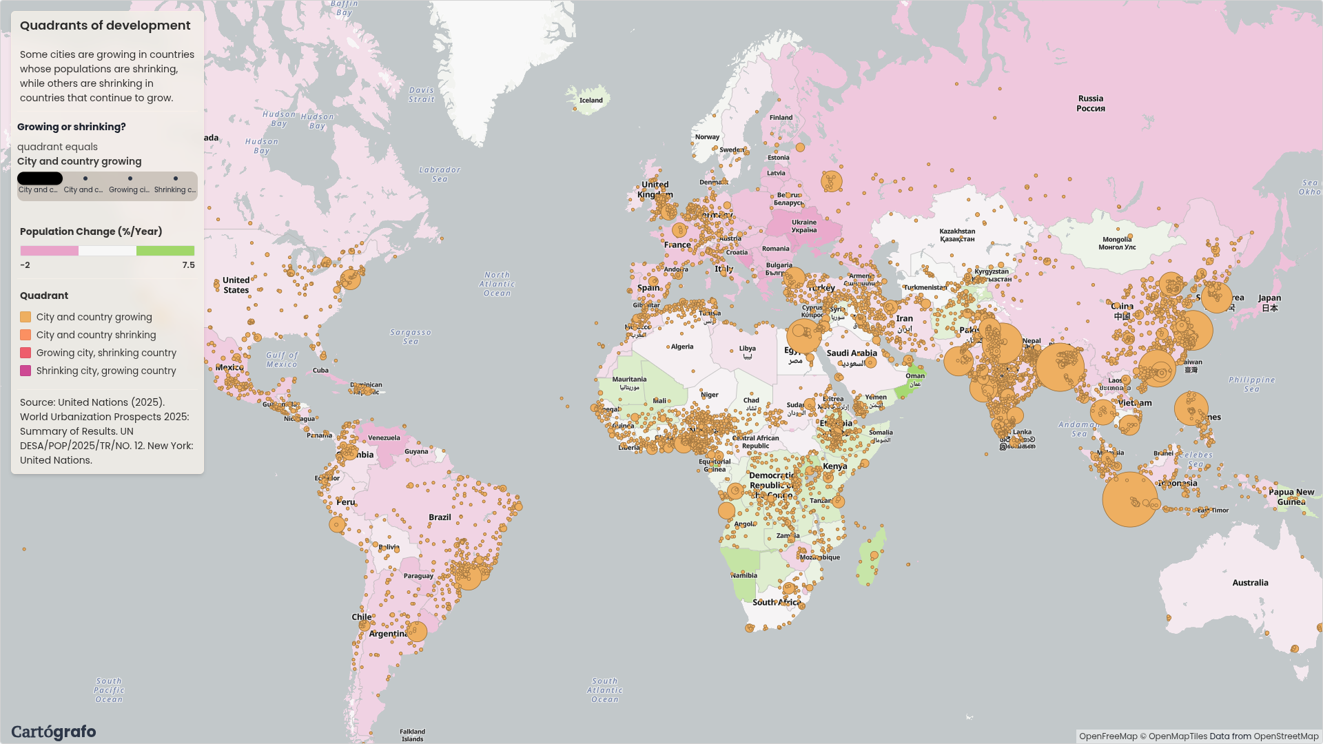
A Cartógrafo map comparing city growth with national population change from 2015 to 2025.
Posts, analyses and visualizations.
A Cartógrafo map comparing city growth with national population change from 2015 to 2025.
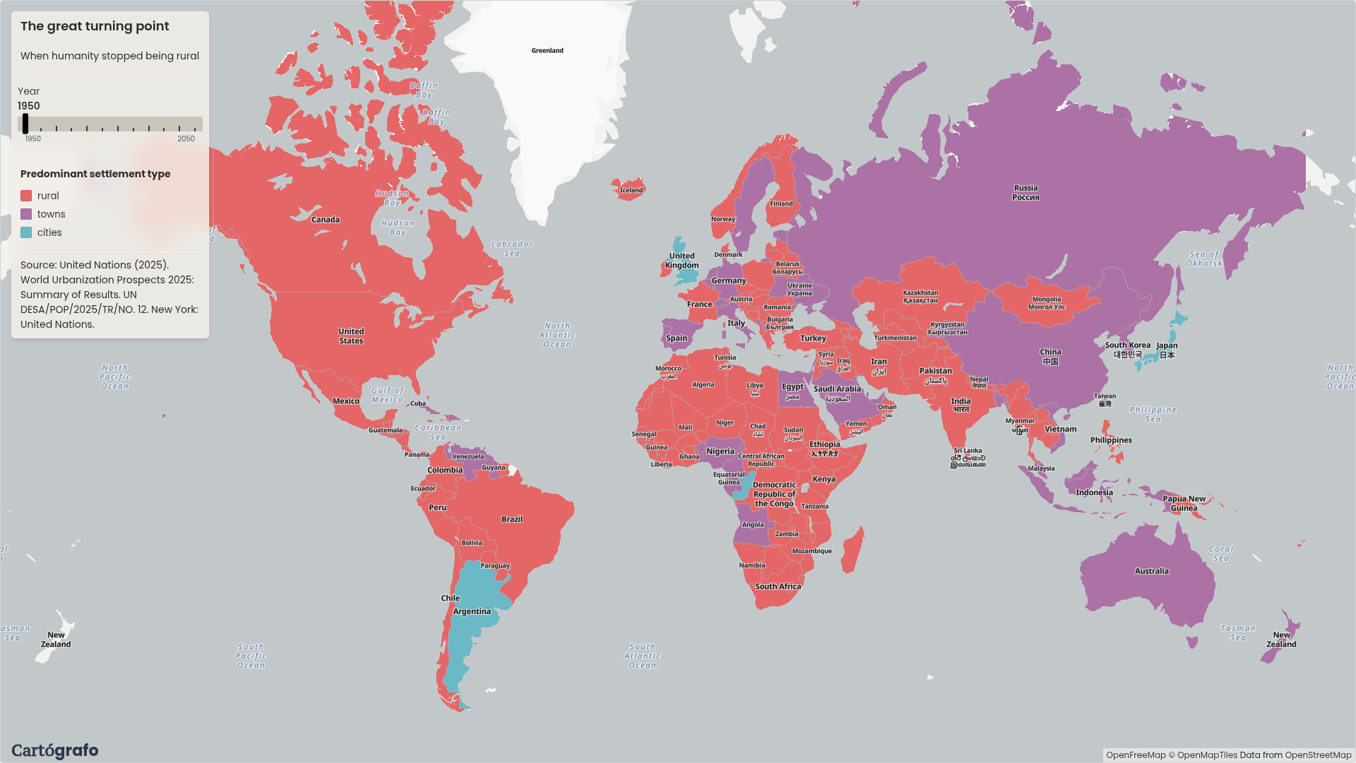
A Cartógrafo map showing whether Cities, Towns, or Rural areas are the predominant settlement type in each country from 1950 to 2050.
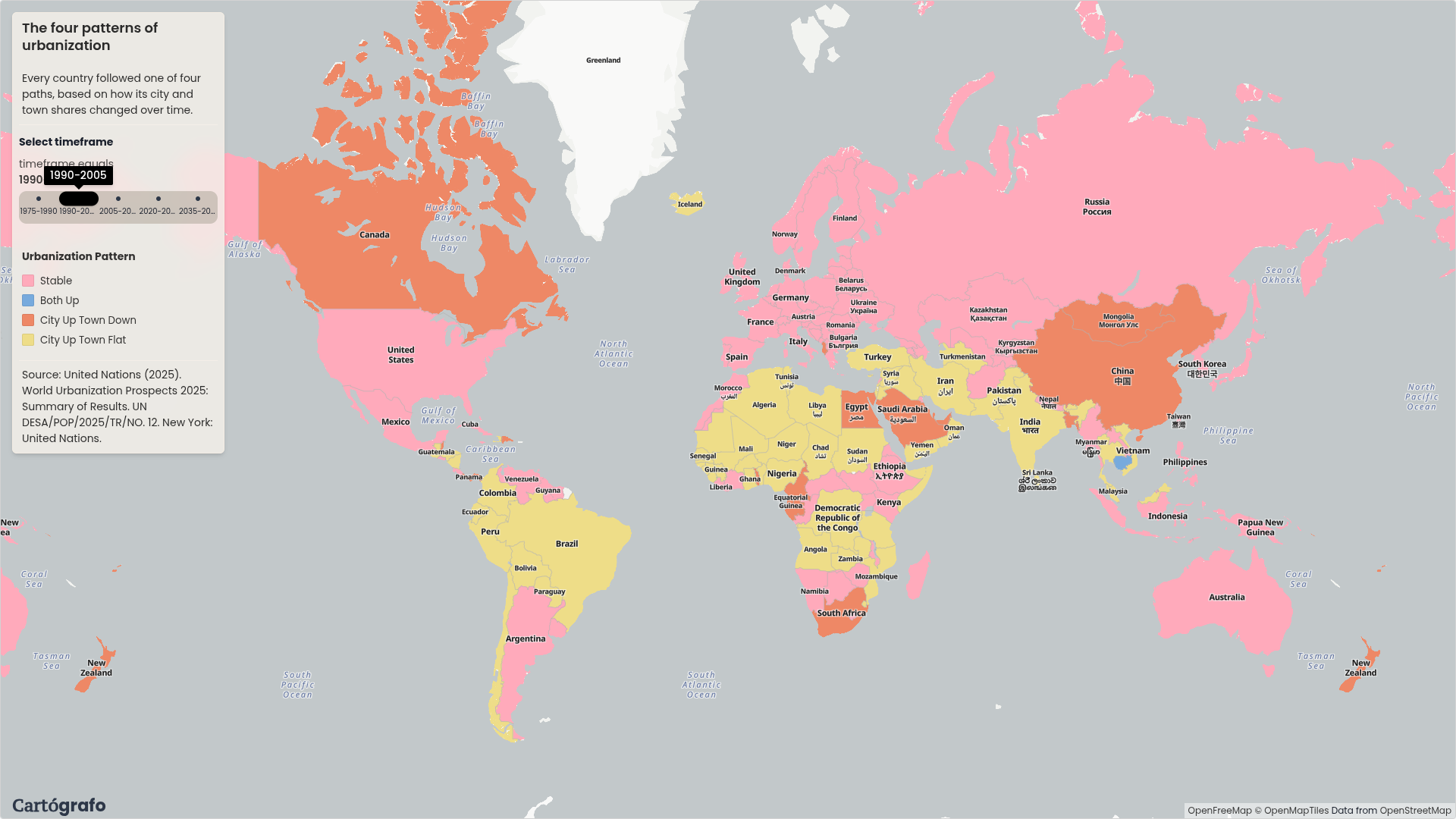
A Cartógrafo map comparing how the population share of cities and towns changed across 15-year periods.